REPORTING & PHOTOS BY Martin Lerigo
Any hike into the Chi Ma Wan Peninsula takes you on trails that are known to only the more adventurous of Lantau’s hikers. This one will be challenging thanks to some seriously steep ascents; you’ll get some amazing views of the South Lantau coastline and you’ll be deep in the ‘jungle’ for much of the time. Far-flung Chi Ma Wan Reservoir (also known as Shap Long Reservoir) is a highlight, and it’s interesting to see the two prisons on its shores, both now defunct.
The first stretch of the hike from Pui O to Mong Tung Wan takes you through a couple of villages to the tiny hamlet of Ham Tin. Soon enough, the road bends sharply to the left, followed 100 metres later by a sharp right, before emerging to an amazing reveal of the estuary and beach.
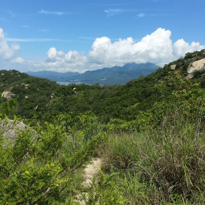
Take the coastline path marked for Mong Tung Wan, and enjoy the wonderful views afforded from its vantage point 100 metres above the sea. You can see both Lantau and Sunset peaks; the Soko Islands in the foreground give way to Wei Ling Ding Island in the mists beyond.
Continuing on, the path hugs the coast for around 1 kilometre and is an accessway for several gravesites and small columbaria, where many ornamental trees have been planted. Finding yourself in Mong Tung Wan, the small stretch of beach fronts three large apartment blocks, now lying empty. Continue along the path as it ascends steeply up 100 metres of hillside. Once at the top, take a right and continue along the coast. As the path turns west, there is an option to descend to the right to Tai Long Wan and the near-deserted Sea Ranch development at Yi Long Wan. But keep straight on, enjoying views across the sea to Cheung Chau, with its pretty harbour, teaming with fishing boats. In the distance, you glimpse Lamma Island and Central.
Here, the thick jungle foliage is interspersed with outcrops of natural bamboo and the occasional grove of planted pine. Continue for another 3 kilometres or so, before arriving at a four-way junction marked with a yellow concrete lotus leaf. Follow the path leading to Chi Ma Wan Country Park Management Centre.

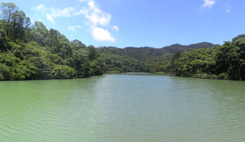
As the path starts to descend into a lush and shady valley, streams flow on either side and rows of Camphor trees line your way. Clambering down, you find yourself in a swampy, misty, humid place, and on your left, you get your first glimpse of deep and mesmeric Chi Ma Wan Reservoir
Clambering down, you find yourself in a swampy, misty, humid place, and on your left, You get your first glimpse of deep and mesmeric Chi Ma Wan Reservoir…
As you continue on, its expanse opens up – a small yet gracefully formed body of water, built to service the two prisons that sit nearby. Emerging, at the reservoir wall, you may well choose to linger for a while, soaking in the glorious view. Next, follow a jungle track, part-concrete, to the entrance of inmate-free Chi Ma Wan Correctional Institution. Dating from 1956, the original prison was the first ‘open’ facility in Hong Kong, later upgraded to house more serious offenders, with high double fences added to the original exterior. Take the road past the now defunct prison officers’ club, and continue along the coast, walking alongside the prison’s outer fence.
Soon enough, you spot the second of Chi Ma Wan’s prisons just ahead, this one a former Vietnamese refugee camp, later converted to a youth offenders’ institution. The path rises above it, affording views of the cell blocks and workshops now gathering moss and dust.
Follow the road to Shap Long, a charming series of three hamlets, astride an estuarial inlet and flood plain, home to water buffalo and migratory birds. Watch out too for fiddler crabs, who, with large claws to the fore, gather food at low tide. From Shap Long, you can head north, taking the well-marked coastal path to Mui Wo (another two hours of hiking), or make your way east back up the hill to Ham Tin and Pui O
